
Where to begin?
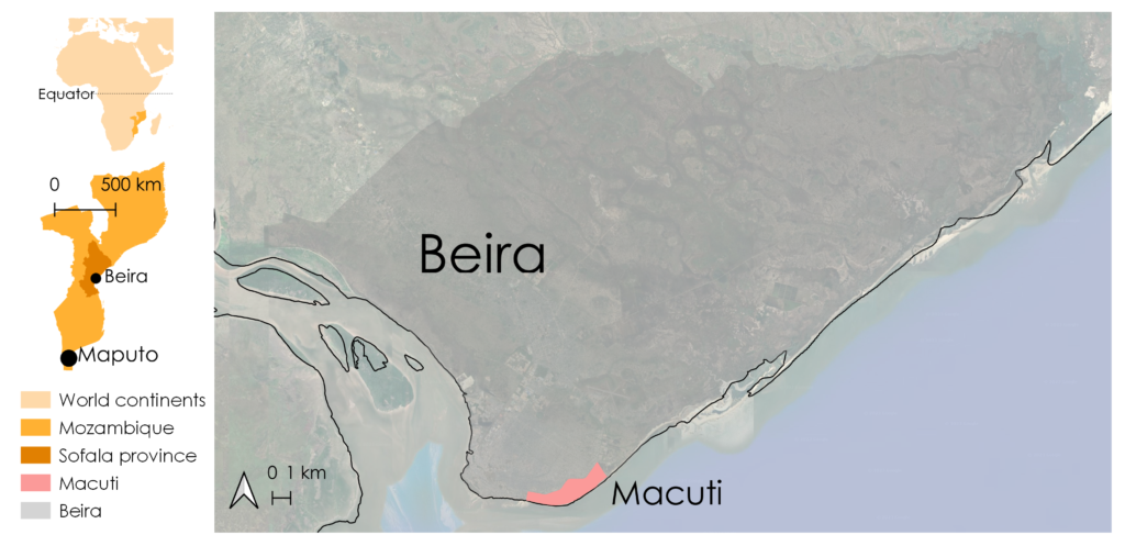
This is the question the University of Trento (UNITN) asked itself when it started working on the second pillar of the MUDAR project: the implementation of a pilot project. Macuti, an informal neighbourhood along the coast of Beira, reported by the municipality as one of the most problematic in terms of lack of infrastructure and services, will be the subject of a small-scale urban regeneration and redevelopment. The main objective of the project is that, through a participatory process, the Beira City Council (CMB), supported by the seven project partners, can intervene in certain areas considered key to improving the living conditions of citizens.
Rainwater drainage, green areas and urban gathering spaces, waste management: these are the macro themes that MUDAR wants to explore in order to meet Macuti’s needs and promote integrated and sustainable urban development. But where to start?

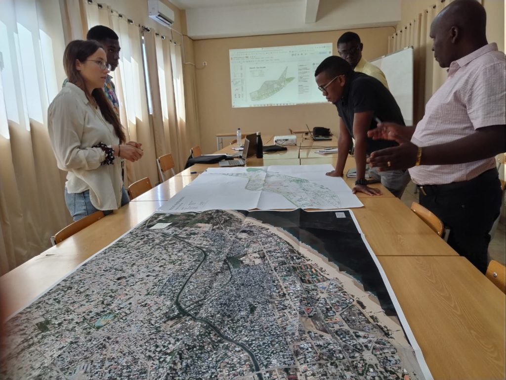
In order to understand how to achieve these ambitious objectives, it is crucial to have a clear starting point. To this end, an initial assessment of the context was carried out during the first few months, delving into the physical and socio-economic characteristics of the area, and also clarifying the current local regulatory framework. In an area characterised by the scarcity of data and the difficulty of accessing useful information, the research methodology had to be broad and cover a multitude of tools belonging to different disciplines.
UNITN together with Universidade Zambeze, the local academic partner, and CAM, the operational arm of Provincia Autonoma di Trento in Beira for MUDAR, began to develop a database in order to take a detailed and as accurate as possible photo – figuratively speaking – of Macuti. To this end, local authorities, public and private entities that have worked or plan to work in the neighbourhood were contacted to find out what infrastructure the area has (or will have) in terms of basic services: aqueduct, sewerage, electricity. And again, remote studies were conducted using Google Earth and data from Sentinel-2 to create a land-use map with information on roads, buildings and green spaces, but also to detect the presence of water on the ground following floods and extreme weather events as evidence of the inefficiency of the existing drainage system.
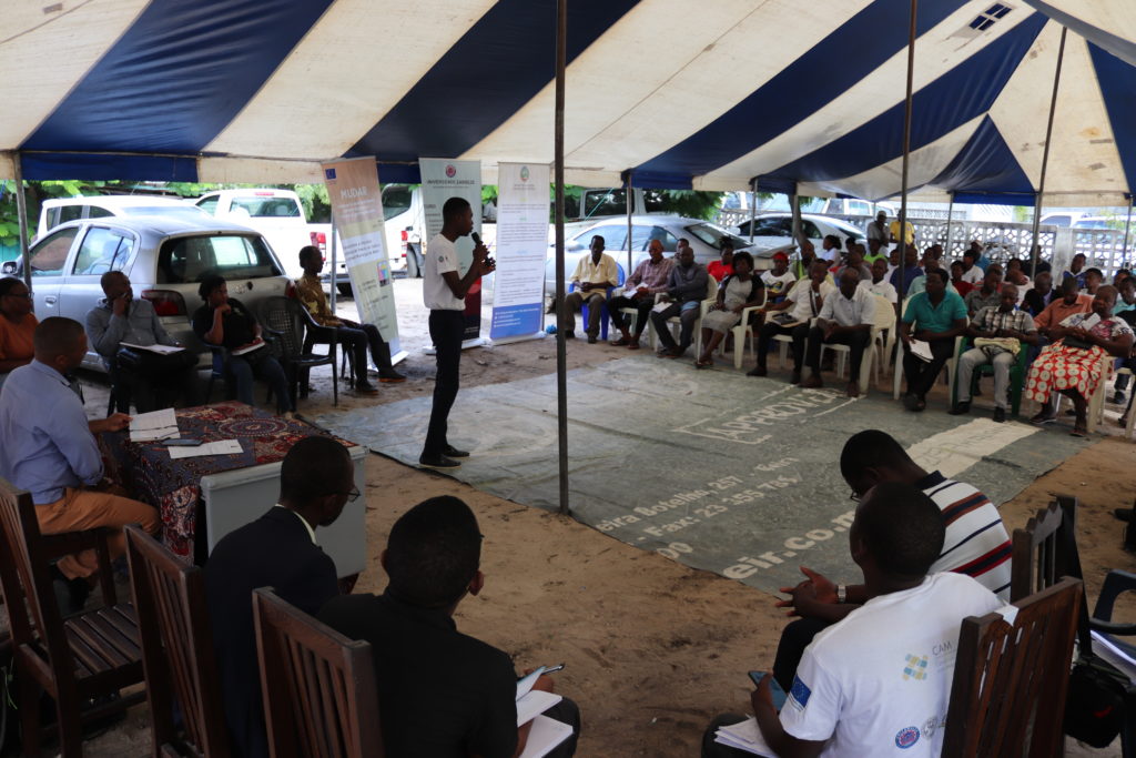
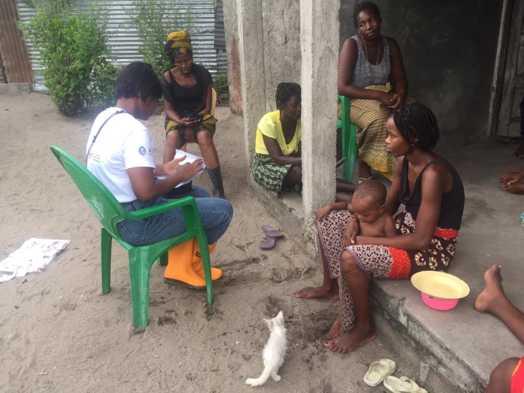
Fieldwork played a central role in this phase. Through 800 questionnaires and 200 interviews, it was possible to enter the homes of Macuti’s inhabitants, the offices of CMB technicians whose work touches the neighbourhood on a daily basis, listen to young cultural associations and old curanderos (traditional doctors), shopkeepers and community leaders. What emerged was a rather broad picture of society, an insight into the advantages and disadvantages of living in Macuti, a litmus test of the challenges the municipality sees for this neighbourhood.
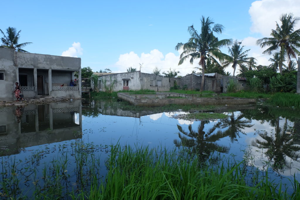
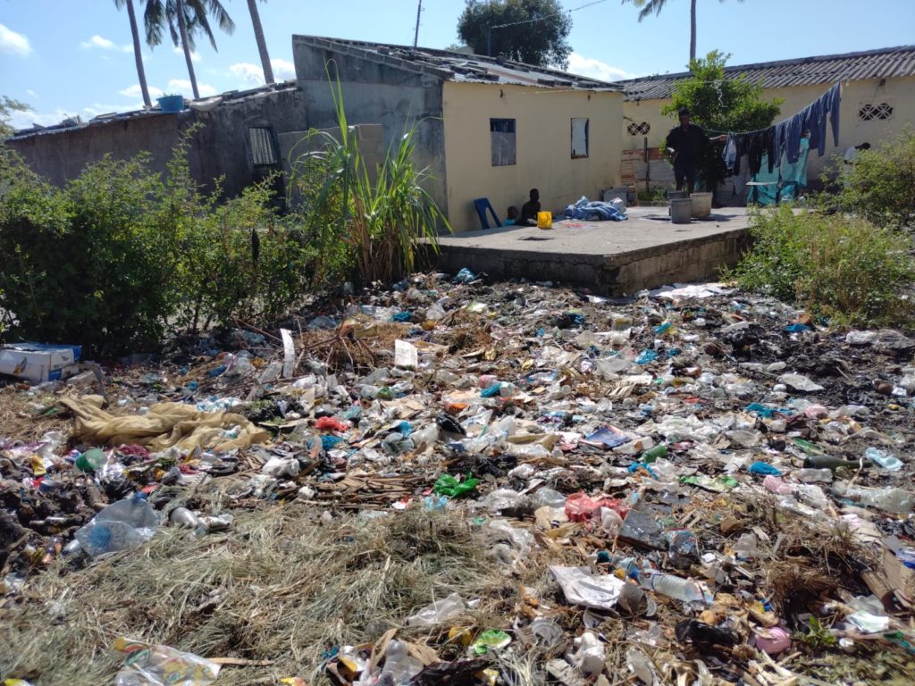
One of the crucial issues which emerged is that flooding caused by heavy rainfall affects about half of the people interviewed, who stated that they are affected at least once a year. Indeed, Macuti is particularly prone to floods, both because of the conformation of the area, which is particularly low, and because of the precarious system of drainage channels in the neighbourhood, which is currently insufficient to guarantee the proper flow of water. Another key concern is waste management: around one third of the population stated that they bury or burn household waste in their yard instead of placing it in the collection points provided by the CMB, putting both their health and the area at risk. In spatial terms, it was observed that people who do not dispose of waste correctly live in the areas furthest away from the collection points, i.e. in those areas of the neighbourhood that are not served by road infrastructure. The latter are related to the last intervention priority that emerged from this phase, namely accessibility to Macuti’s services and community spaces. More than half of the neighbourhood’s inhabitants (around 80 per cent) rated the community green areas as poorly or hardly accessible.
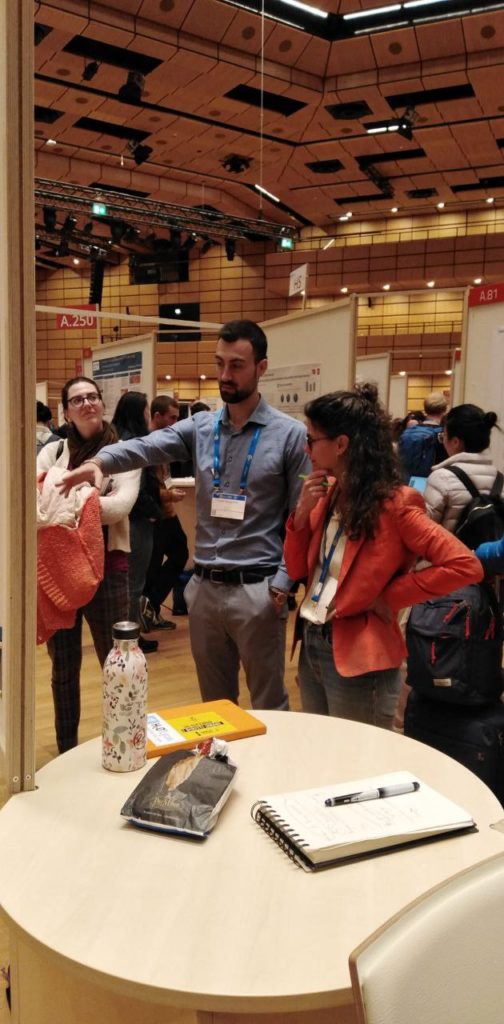
The first elaborations of these data were presented last month in Vienna at the European Geoscience Union (EGU) conference. At the beginning of June, they were finally returned to the inhabitants of Beira. It is precisely the latter that will be called upon to intervene in the design phase of the project alternatives that will follow and to participate in the drafting of the executive project through a participatory process that starts from the bottom.